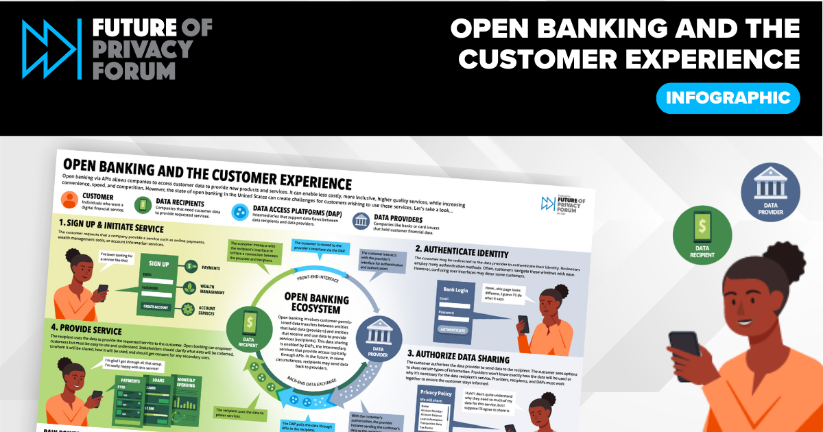
Open Banking Infographic
FPF’s infographic on “Open Banking And The Customer Experience,” visualizes the U.S. open banking ecosystem. Open banking involves customer-permissioned data transfers between organizations holding data and entities that provide financial products and services (e.g., wealth management, payments, and loan access). The Open Banking Infographic is supported by over a year of meetings and outreach with leaders […]

Student Voices: LGBTQ+ Experiences in the Connected Classroom Report & Infographic
Infographic and Report, Student Voices: LGBTQ+ Experiences in the Connected Classroom, was developed through a partnership with LGBT Tech, a national, nonpartisan group of LGBT organizations, academics, and high technology companies, builds on FPF and LGBT Tech research, including interviews with recent high school graduates who identify as LGBTQ+, to gather firsthand accounts of how […]
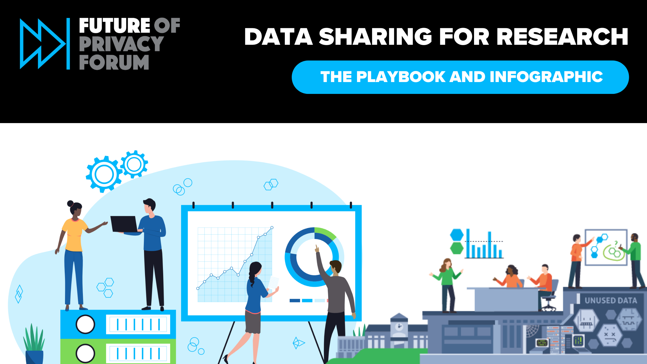
The Playbook: Data Sharing for Research Report & Infographic
The Playbook: Data Sharing for Research is an FPF report on the best practices for instituting research data-sharing programs between corporations and research institutions. FPF also developed a summary of recommendations from the full report as well as an infographic on The Value of Responsible Data Sharing for Research. The playbook addresses vital steps for data […]

Understanding Extended Reality Technology & Data Flows Infographic
This FPF infographic visualizes how extended reality (XR) data flows work by exploring several use cases that XR technologies may support. The infographic highlights the kinds of sensors, data types, data processing, and transfers that can enable these use cases. XR technologies are powered by the interplay of multiple sensors, large volumes and varieties of […]
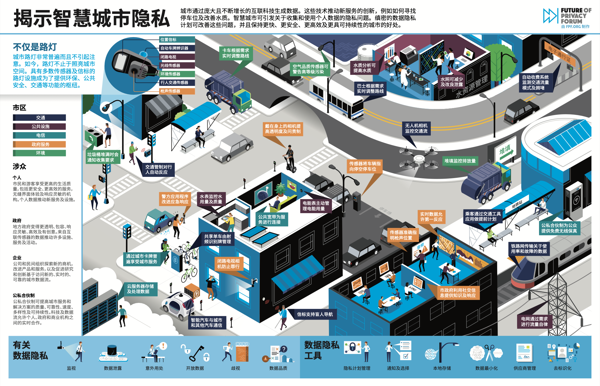
FPF Infographics – Chinese Translation
As FPF’s work expands to include an international audience, we are pleased to relaunch FPF’s popular infographics in various languages. Because conversations around data protection have become more global, the need for high-quality information and new forms of communication in different languages continues to increase. 1. Data and the Connected Car The infographic, “Data and […]

Privacy Best Practices for Rideshare Drivers Using Dashcams Infographic
FPF and Uber have created a guide for US-based rideshare drivers who install “dashcams” – video cameras mounted on a vehicle’s dashboard or windshield. Many drivers install dashcams to improve safety, security, and accountability; the cameras can capture crashes or other safety-related incidents outside and inside cars. Dashcam footage can be helpful to drivers, passengers, […]

Student Monitoring Explainer Infographic
The infographic Understanding Student Monitoring depicts why schools monitor student digital activities, what types of student data are being monitored, and how that data could be used. While student monitoring is not new, it has gained significant traction recently due to the shift to remote learning and the increase in school-managed devices being issued to […]

Youth Privacy and Data Protection Infographic
The Youth Privacy and Data Protection 101 infographic provides an overview of the opportunities and risks for kids online, along with potential protection strategies. It also features young people’s voices from around the world on their preferences and attitudes toward privacy. Risks for youth online include well-known concerns such as coming across age-inappropriate content, encountering […]
Understanding Interconnected Local and Global Data Flows Infographic
International data flows have been top of mind in the past year for digital rights advocates, companies, and regulators, particularly international transfers following the Schrems II judgment of the Court of Justice of the EU in July 2020. As data protection authorities assess how to use technical safeguards and contractual measures to support data flows […]
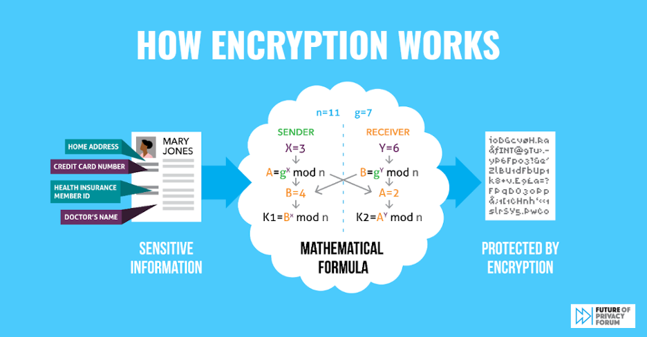
Strong Data Encryption Protects Everyone Infographic
The Strong Data Encryption Protects Everyone infographic illustrates how strong encryption protects individuals, enterprises, and the government. FPF’s guide also highlights key risks that arise when encryption safeguards are undermined – risks that can expose sensitive health and financial records undermine the security of critical infrastructure, and enable interception of officials’ confidential communications. FPF’s infographic […]